The Hexagon Imagery Program (HxIP) is a cloud hosted service offering high quality, accurate geo-referenced and ortho-rectified imagery. This imagery can be accessed in MicroSurvey CAD using the Global Mapper SDK. The steps below outline the configuration and usage basics for MicroSurvey CAD. The procedure for STAR*NET is similar through the Network Plot options.
On this page:
Evaluation Accounts
Click here to request a demo - This evaluation account provides a 15-day trial, with access to all of the HxIP regions.
If you have trouble please contact MicroSurvey at 1-800-668-3312.
Configuration Steps
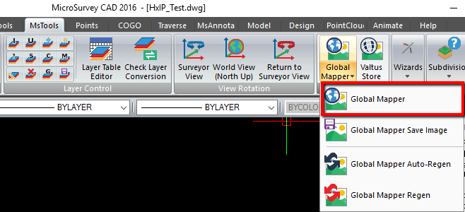
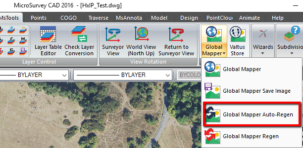
- From the MsTools menu, pick Global Mapper:
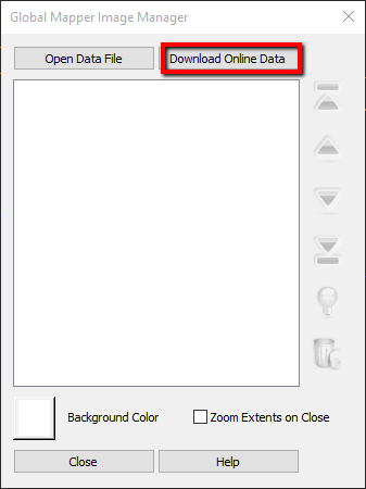
- Select Download Online Data:
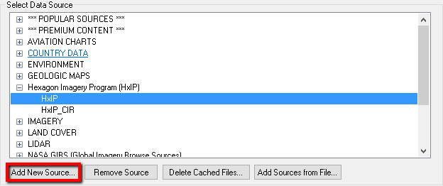
- NOTE: If you are using MicroSurvey CAD 2016 SP1 or later you can skip to Step 10.
Select Add New Source:
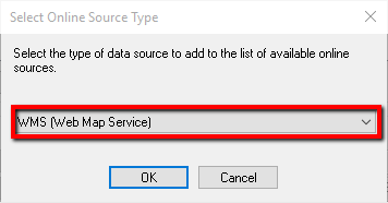
- Select WMS (Web Map Service) as the source type:
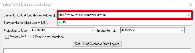
- Enter the Server URL, this is http://www.valtus.com/views/wms and leave other settings default values:
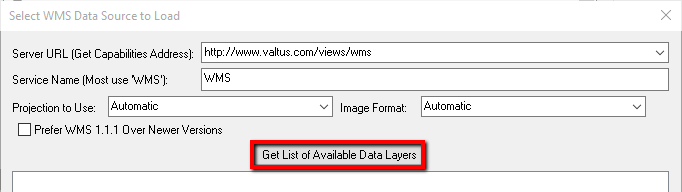
- Select Get List of Available Data Layers:
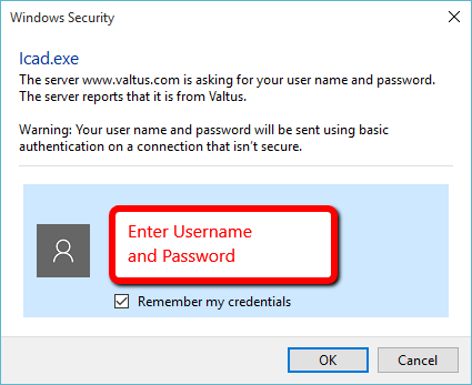
- Enter your username and password for your subscription:
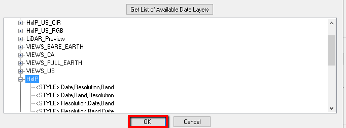
- Pick the desired Layer and select OK:
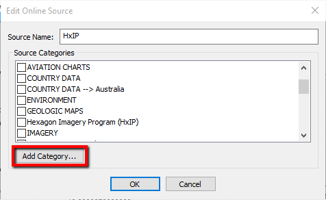
- Optionally Add Category for HxIP layers, or select an existing category:
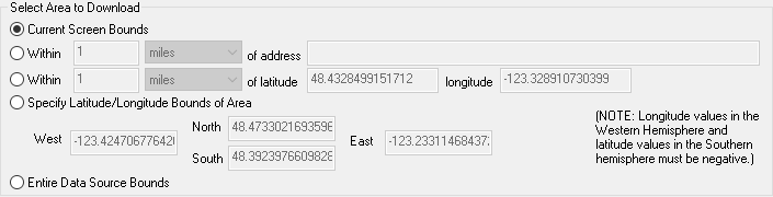
- With your layer selected, you can set Area to Download. "Current Screen Bounds" is a good one to start with:
- Choose your Resampling Method, in most cases the default "Bicubic Interpolation" is a good choice:

- Choose whether to restrict source to selected bounds
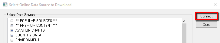
- Click Connect:
- Click Close to load the selected layer:
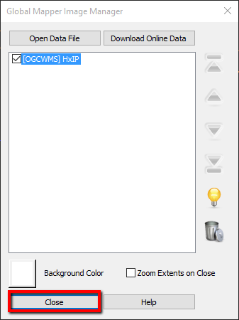
- You should now have the HxIP imagery loaded into your drawing.
Global Mapper Options
By default the imagery will auto-regen every time the view changes, however that can have a negative impact on performance. Manual regens are possible with a toggle.
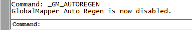
- Toggle the Global Mapper Auto-Regen:
- The command line indicates the status after the toggle:
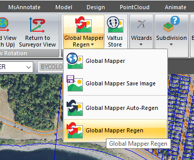
- Now you can zoom and pan much quicker. Perform a manual regen by using the Global Mapper Regen option:
Layers Legend
List of available layers include:
- HxIP_CA_CIR - The Colour Infrared or 4th band imagery component for the Canadian data.
- HxIP_CA_RGB - The 3 band imagery component for the Canadian data.
- HxIP_US_CIR - The Colour Infrared or 4th band imagery component for the US data.
- HxIP_US_RGB - The 3 band imagery component for the US data.
- LiDAR_Preview - Allows you to determine if there is LiDAR data available within your current view.
- VIEWS_BARE_EARTH and VIEWS_FULL_EARTH - The hillshade raster layers of the entire LiDAR library.
- VIEWS_CA and VIEWS_US - Layer specifically including all data for Canada and US respectively.
- HxIP and HxIP_CIR - Cached layers for optimized performance. NOTE: These are the recommended layers.
- VIEWS - Grouping of layers that the user is subscribed to, and can be altered.
- VIEWS_2 - Optimized cached layer, cannot be altered.
See this Valtus page for more information.
Jacob Wall
Comments