Once post processed, STAR*NET users often export baselines of static GPS observations to STAR*NET so these measurements can be combined with other measurement types for a properly weighted and adjusted network. EZ SURV allows for this process:
Pick Here to see movie.
Export from EZ SURV:
1. Import Rinex file into EZ SURV
2. Post Process (see video linked to here for an overview)
3. Tools | Export | Baselines...
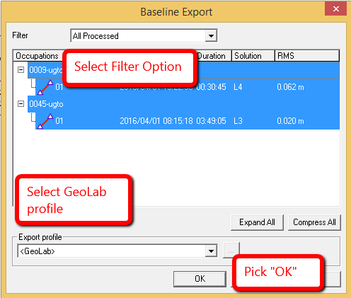
4. Pick "OK"
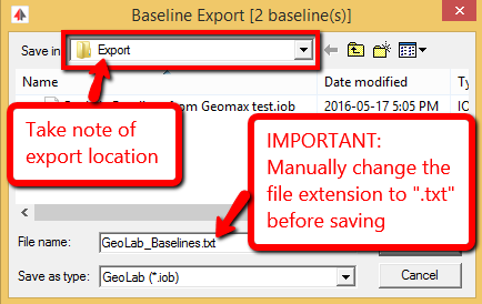
5. Close EZ SURV and open a STAR*NET Project
Import into STAR*NET:
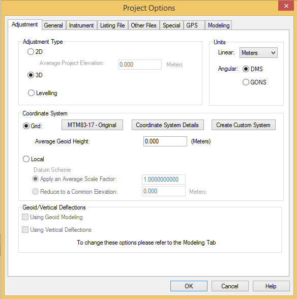
6. Set appropriate Project Options such as Coordinate System, 3D or 2D and Project Units:
7. Input | Import GPS Data
8. Select the "GeoGenius" GPS Data Format
9. "Select Input Files" and browse to the text file you exported from EZ SURV
8. "IMPORT!"
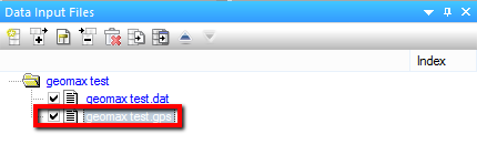
9. A new file with the extension ".gps" will be created and added to your project Data Input Files panel:
The process is complete
James Johnston
Comments