Steps in Leica Geo Office
1. Open your Leica Geo Office Project
2. Export
3. Export ASCII Data
4. In the “Save as type” field, choose the “SKI ASCII file" option
5. Pick "Settings" and configure:
- On the General tab dialog, select “Baselines” for File Type,
- select “Cartesian” for Coordinate Type,
- and in the “Include items” area at the bottom of the dialog, the “Keywords” and “Header” boxes should be checked.
- Then finally, on the Baseline tab, make sure the “Covariance” item is checked so that vector weighting is exported.
6. Pick "Export"
7. Select a location and name for your .asc file
Steps in STAR*NET
1. Create a New Project or open an existing one
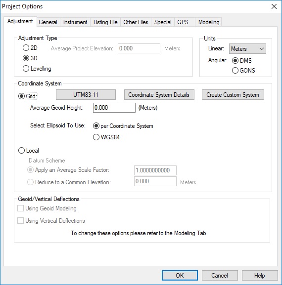
2. In Options | Project ensure that the "Adjustment" tab is configured properly.
- Select the correct units
- Select the correct Grid Coordinate System
- Select 3D or 2D
- Assign an average elevation if you have selected 2D
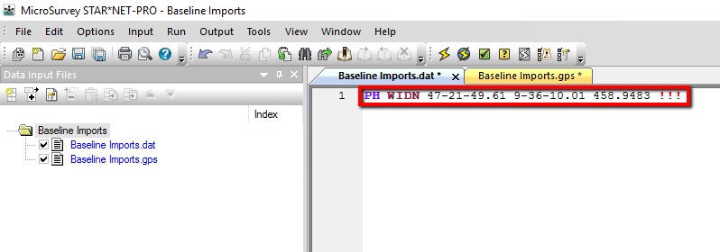
3. Be sure that you have constrained a point to use for control in your project. In the example below I have entered a lat/long for the WIDN point and entered it as a "PH" record that is held fixed using the "!!!" symbols:
- Enter a PH record here:
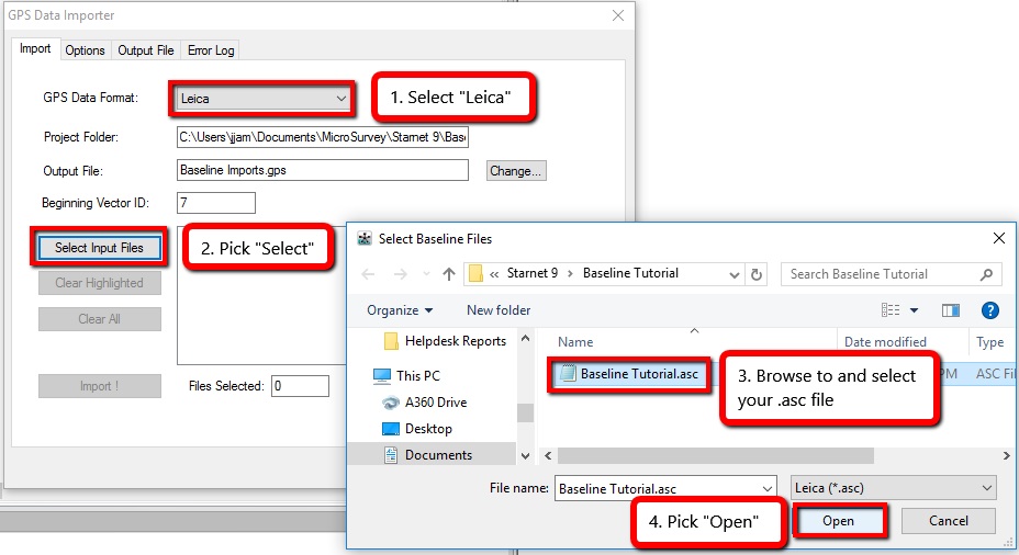
4. Now open Input | Import GPS Data
- Select "Leica"
- "Select Input Files"
- Browse to the SKI ascii you exported
- Open
5. Pick "Import"
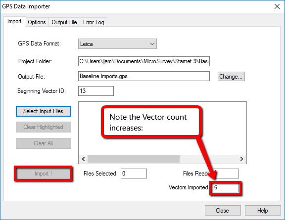
6. Close the import dialog. Note that a new "*.gps" file has been added to your project Input panel:

7. Configure the options and run your adjustment.
James Johnston
Comments