Some users have reported that point elevations in STAR*NET do not match with those collected in the field with FieldGenius. Do note that this does NOT lead to Field elevations being incorrectly computed, this is ONLY when processing the data into STAR*NET.
FieldGenius:
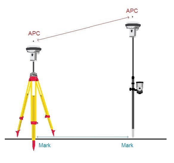
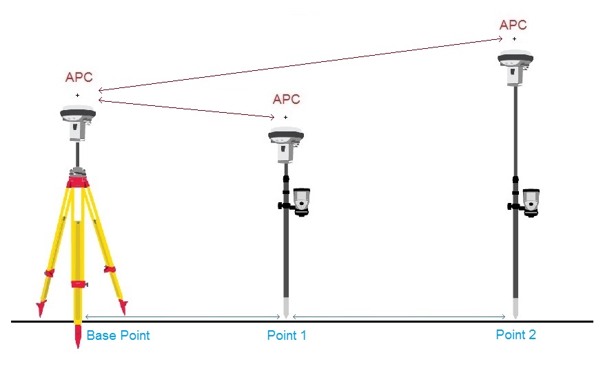
In STAR*NET, the G1 line contains the DX, DY and DZ dimensions between the Base and Rover, as well as Antenna Heights of both. When importing FieldGenius vectors into STAR*NET, these values are read from the BL line, which can be found in the FieldGenius raw file.
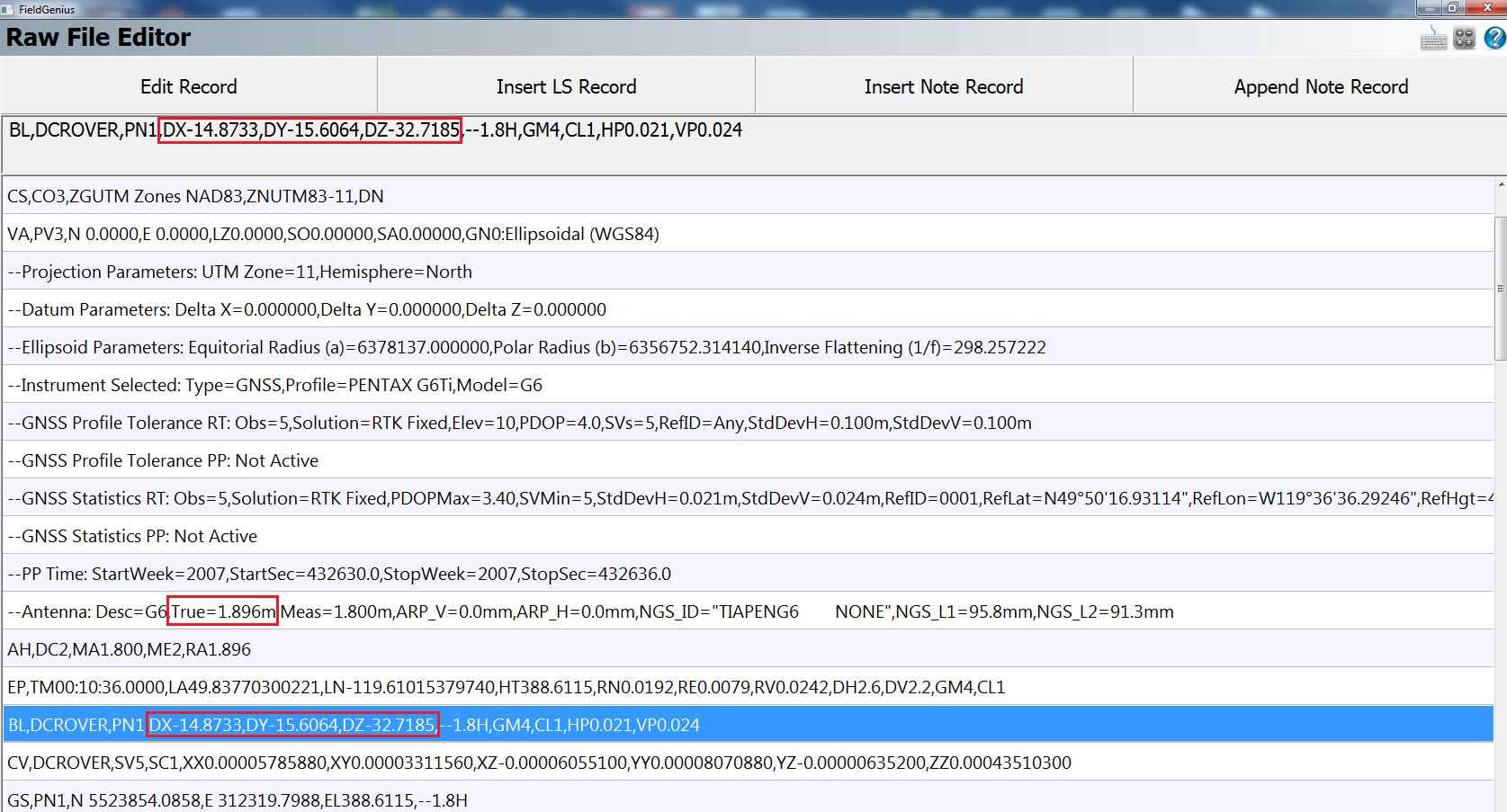
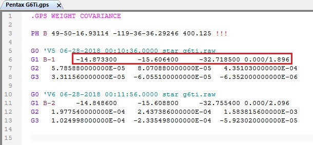
Certain receivers report that BL line as mark to mark, while others report it as Antenna-Phase-Center to Antenna-Phase-Center (APC) in the vector file. The STAR*NET converter assumes the vectors are APC to APC so it includes the Antenna heights when you import it into STAR*NET, whether be it APC to APC or Mark to Mark.
To determine what your receiver is reporting, you can perform the following Antenna Height Test
- Start by creating a new Project in FieldGenius and take two shots on the same elevation, but with noticeably different Antenna heights. (Make sure to change the Antenna height in FieldGenius as well!)
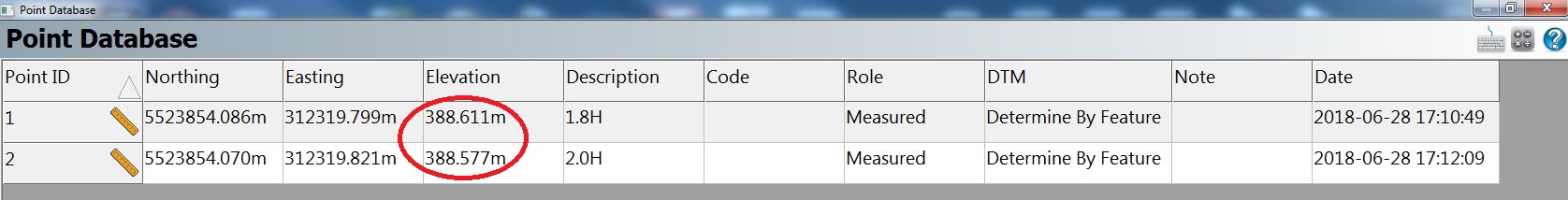
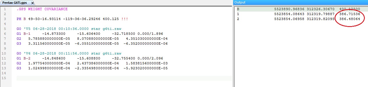
- Then, import that project into STAR*NET and run the adjustment. Take note of the elevation of those points under Coordinates in the Output tab. Then, open Field Genius and look up the elevation of those points in the Point Database.
- If STAR*NET elevations do not match the FieldGenius elevations, then your rover records Mark to Mark vectors in the BL line and the Antenna height must be commented out in order to get correct elevations. You can run our online utility to comment out all the Antenna heights instead of manually doing so by running our Vector Modifier online utility.
- If STAR*NET elevations match the FieldGenius elevations, then your rover records APC to APC vectors in the BL line and the Antenna height section is necessary in the G1 line, so it should not be commented out.
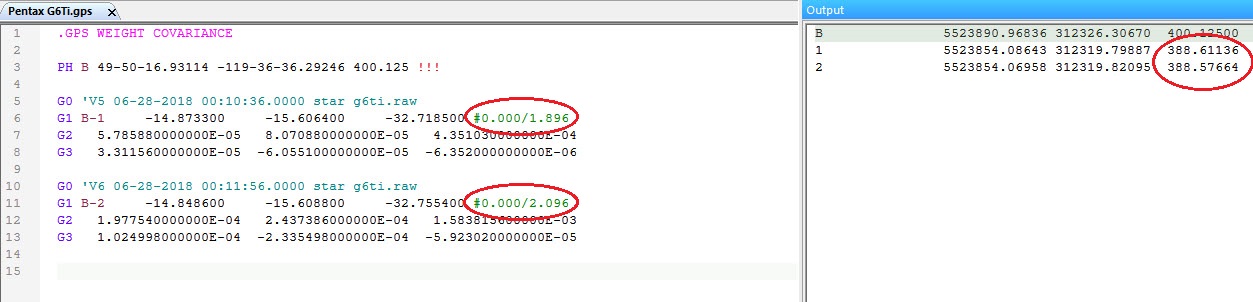
Here is an example in which the Antenna heights had to be commented out:
FieldGenius:
This is because when the instrument reports APC to APC, it applies the Antenna Height to those values to give the correct elevation of the Mark. When the instrument reports Mark to Mark, it is applying the Antenna Height difference to already calculated Mark shots and is causing an error in the readings in STAR*NET. Now if the Antenna Heights were the same (i.e., the Base height is the same as the Rover height), then no difference will be noticed, and it will appear as if the instrument was reporting Mark to Mark. That is why it is necessary to perform this test with noticeably different Antenna heights to determine if your instrument is reporting APC to APC or Mark to Mark.
You can find a list of known Instruments below that show if they report APC to APC or Mark to Mark:
| APC to APC | Mark to Mark (Must be commented out) |
APC(Base) to Mark(Rover) |
| Topcon HiPer Ga/Gb/Plus | Stonex S9i/S10 | Hemisphere S631 |
| Spectra SP80 | Hemisphere S321 | |
| Altus APS-3 Rev 2 | Leica GS14 | |
| Javad Triumph-1 | Leica GS15 | |
| Leica GS16 | ||
| Leica 1200 | ||
| GeoMax Zenith 35 | ||
| Pentax G6Ti and G6Ni |
*NOTE: The APC to Mark category has been added. With that category it is necessary to edit the .GPS file so that the Base Antenna Height is "as imported" but the rover Antenna Height should = 0.00. Please perform a test to confirm these details as results can vary as firmwares and softwares are updated.
James Johnston
Comments