STAR*NET allows users to apply geoid modeling to adjustments. Modeling is most commonly accomplished by use of a geoid and vertical deflection information. It can have two aspects, geoid height modeling and vertical deflection:
1. Geoid height is interpolated from a geoid file and applied to GNSS vectors and any point record suffixed with an H (CH, PH and EH)
2. Differences in Geoid height between stations are applied to modify computed elevations from conventional zenith observations (except sideshots)
3. When enabled, deflection of the vertical values are included in the computation and complete the task of correctly modeling your network.
To correctly model conventional observations, STAR*NET requires:
-either an average geoid height
-or specifying a geoid file and vertical deflection information
This article discusses ways of specifying vertical deflection information to properly model conventional observations. GNSS observations or leveling observations do not require deflection of the vertical information.
___________________________________________________________________________________________________________________________
Vertical deflection values can be interpolated from a VDH file generated by the StarGeoid utility that is installed with STAR*NET. This functionality is available to US surveyors as it requires vertical deflection files published by NGS.
___________________________________________________________________________________________________________________________
For other regions, deflection of the vertical values can also be specified for each station in a network using the GH input type:
ie:
#GH name N(m) Xi(arcsec) Eta(arcsec)
GH 103 -15.964 4.6 -5.6
____________________________________________________________________________________________________________________________
In Canada, the GPS-H utility, available to anyone who creates a free account at Natural Resources Canada can be used to create such an input:
- Configure the STAR*NET project so that:
- The required geoid file is specified in Project Options | Modeling
- Select the option to output a Geodetic Position File in Project Options | Other files
- Run the adjustment. (note that small elevation residuals will be introduced to stations computed by conventional observations at this stage)
- Close the project, and run GPS-H:
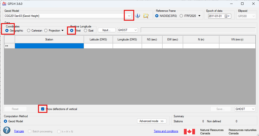
- Configure GPS-H as shown (select the appropriate geoid height file for your project):
- select the format button to the right of "Input..." and select "Edit..."
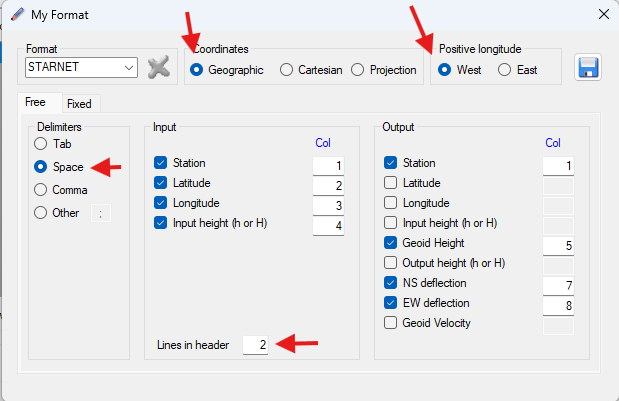
- create a new format named "STARNET" and configure as shown:
- Select the "Save" icon
- Pick "Input..." and browse to the POS file in the same location as your STAR*NET project
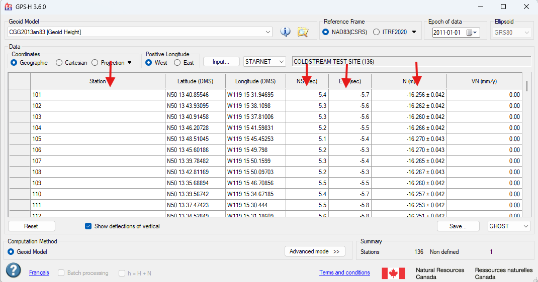
- GPS-H will compute a Geoid Height, NS deflection value (eta) and EW deflection value (xi) and display them:
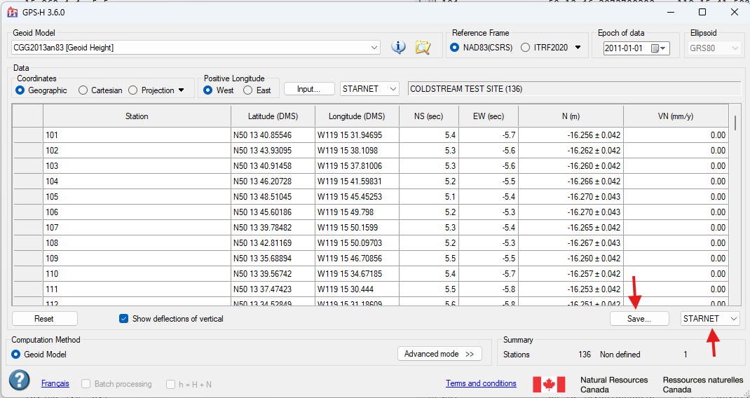
- Select the STARNET export option and then "Save" in the bottom right section of the dialog:
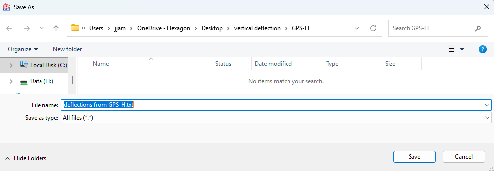
- Specify a name and location for the file you are creating. Add the extension ".txt" to the file to make it easy to edit and then save.
- Open Excel and start a new workbook
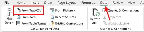
- Select the Data ribbon and select "From Text/CSV" in the "Get & Transform Data" section:
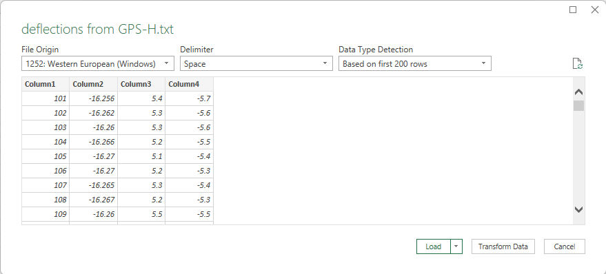
- Excel will be able to parse the data as space separated and display a preview. If it looks correct, select "Load"
- Once loaded in Excel, right click on the "A" column and select "insert"
- Enter the text GH and then at least one space in cell A2:
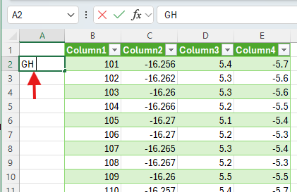
- Select cell A2 and the "pull down" tool in the bottom right corner. Drag the cell all the way down to the last line in your workbook so that Each station name has a "GH " entry preceding in the A column:
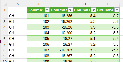
- File | Save as... and select Text (Tab Delimited).txt and enter a name and location for your file.
- It is best to store this file in the same location as you other data files for the current project
- You will see a warning that this format does not support some Excel features, you can disregard.
- Close Excel
- Open the folder containing this new file and change the file extension to ".dat"
- Reopen the STAR*NET Project
- Use the "Data Input Files" panel to add the file you have just created
- Edit the new input file and remove the first row
- Your final result will appear as below:
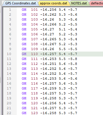
Each GH line will specify the correct geoid height, Eta and Xi for each station in your network
Now when you run STAR*NET with a Geoid applied, vertical deflection values given in the GH lines will compensate for small vertical residuals introduced by applying the geoid in the Modeling options. Your conventional and GNSS observations will be combined accurately and rigorously.
FULTON Kiera
Comments
David Ibbotson
Great stuff, I will start some testing for the Australian market.