The Nautiz X7 has an onboard "hiker grade" GPS receiver that can be used for rough surveying and finding evidence. It is possible to localize to known control points just as you would with a full RTK GPS system.
You do not need to purchase the GNSS license for FieldGenius in order to use this, it is included free with all versions of FieldGenius 2010 (and newer) for the Nautiz X7. Please note, the GNSS license is still required if you want to connect to a survey-grade receiver such as an RTK or NTRIP/GPRS system.
The Nautiz X7 comes pre-loaded with a GPS Profile named "Nautiz X7". Simply select it from the Instrument Settings screen by selecting the "GPS Rover" instrument type.
Run FieldGenius
After opening a project go to Settings | Instrument Selection
Pick the "GPS Rover" radio button
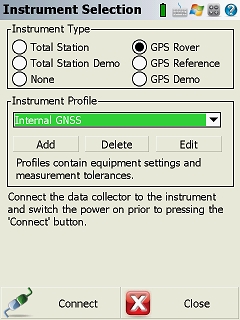
Highlight the "NAUTIZ X7" profile and press the "Connect" button.
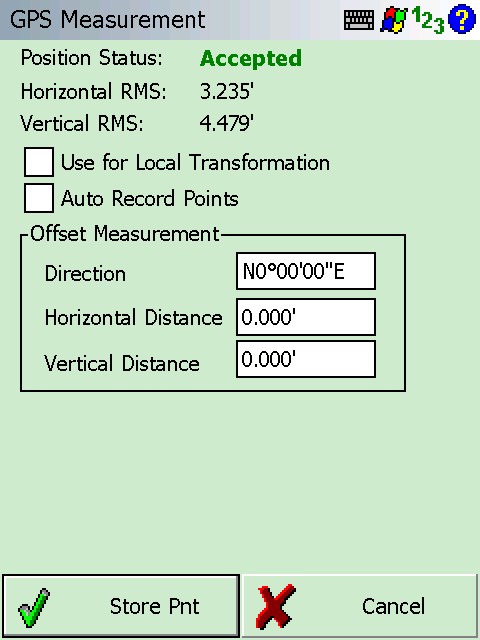
After connecting you will proceed to the map view. Press the measure button.
In the store dialog that follows, you can store points in raw UTM or State Planes coordinates, or you can check on the "Use for Local Transformation" checkbox to match this point to a known control point already in the database so that you can work in an assumed coordinate system.
If the "Nautiz X7" rover profile is ever deleted or accidently changed you will need to recreate it following the steps below:
Run FieldGenius
After opening a project go to Settings | Instrument Selection
Pick the "GPS Rover" radio button
Pick on "Add" below the Instrument Profile pulldown
Type a name for your profile and Enter
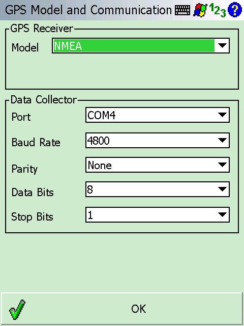
Pick Edit | Model and Communication
Configure your profile as shown below:
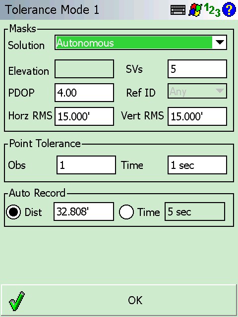
Pick on Tolerance Mode 1 and configure as shown below:
James Johnston
Comments