This information applies for importing leveling data from Trimble Data Exchange Format, Leica GSI or Trimble Dini files:
When collecting leveling data using an electronic level, for best results a naming scheme or number range should be used to make it clear which points should be considered "Stations" and which should be considered "Turnpoints." This naming scheme must be applied in the field. This allows you to specify the points that will be considered stations when running your converter as in the dialog below. In this example all stations were given alphabet characters as names:
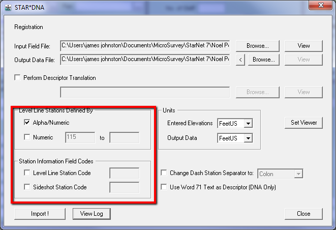
This will allow the converter to "summarize" all the observations between stations so that only the elevation and distance or number of turns between permanent benchmarks are included in the dat file. This way you are not including non-permanent points in your network and you will cut down on the size of your network.
But in some cases the data has already been collected without the naming scheme being used. As an alternative you can edit your data file using Notepad and insert a ".point" or ".p" inline to specify which points will be considered stations.
Here is an example kindly provided to us by Pat Simon at Baltimore County Land Surveying Division:
Problem:
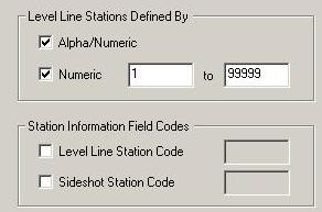
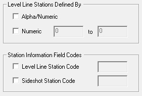
Baltimore County Land Surveying Division conducted a number of level loops around their benchmark network. The data had been collected using the default point names, with no differentiation between stations and turnpoints. At first they were able to use STAR*NET to process their data even though the turnpoints were being included in the data. When running the converter the Numeric point range was entered so that it included all the points as below:
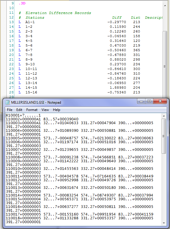
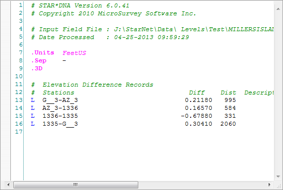
When the converter was run it would output a dat file which included all turnpoints. See the screenshot below of the dat file and the source gsi file:
HOWEVER, in time this procedure caused a problem! The network was large enough that the number of stations quickly approached STAR*NET's 10,000 point limit and a solution had to be found. Fortunately the .point inline option allowed for the data in the gsi files to be re-used without re-doing the fieldwork:
Solution:
NOTE: The .P option is not recognized in newer releases of STAR*NET. You may need to run an older version of the STAR*DNA converter. Download V7 from this link:
http://helpdesk.microsurvey.com/article/869
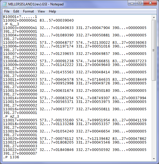
The gsi files were edited so that the .point or .p inline option was used to specifically designate which points were to be considered stations, and a naming scheme was used during the conversion process that excluded all points in the gsi file. In other words, the inline option designated the stations and the naming scheme method was ignored during the conversion process.
See in the example below how an entry in the format: .P PointID was insertered before an observation to a station occurs:
This revised GSI file was converted using the STARDNA converter configured as below. There is no range specified for Level Line Stations as the .p inline message in the GSI file accomplishes that task:
The resulting dat file includes observations to all permanent points but leaves out the temporary ones; resulting in a much smaller network that identifies only the permanent benchmarks:
James Johnston
Comments