The new user defined ASCII Export feature in FieldGenius 7 provides users with a wide variety of export options. Here's a short guide to showing you how you can export GPS points directly to Google Earth for your own inspection and for export to clients. You will require FieldGenius Version 7.1 or newer to perform this operation:
1. Open a project which contains GPS Measurements
2. In Menu home | Import/Export | Pick ASCII Coordinate file Export
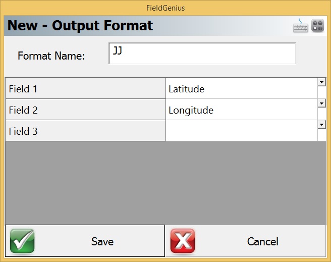
3. Pick the "New Format" button shown below:
4. Define your new format as shown:
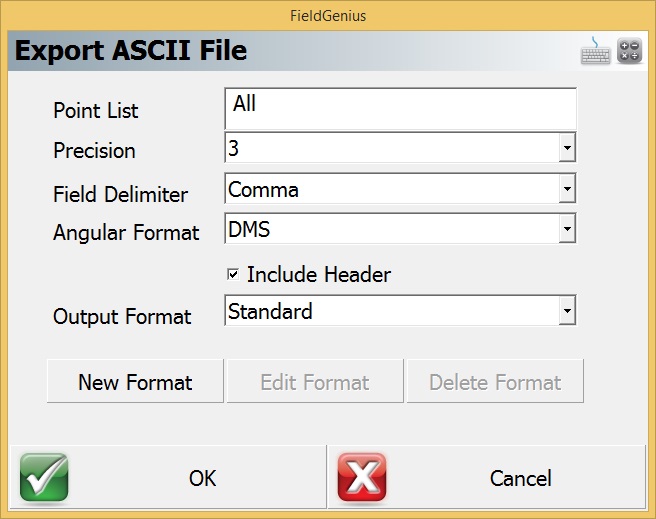
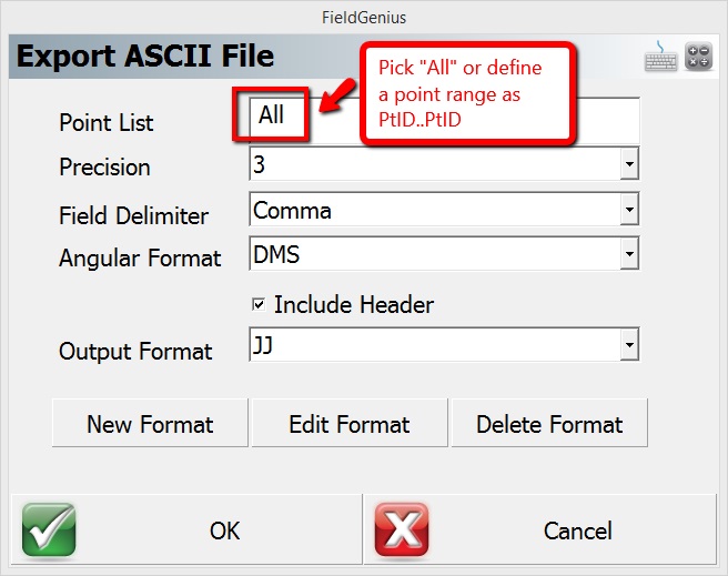
5. Next, configure your output options as shown and pick "OK"
6. Pick a location to create the file in your data collector, and give it the extension csv or txt.
7. Next, copy the newly created file from your data collector to a desktop computer.
8. Open a website that can create Google Earth files from text files. In this example I'm using the website "Earth Point:"
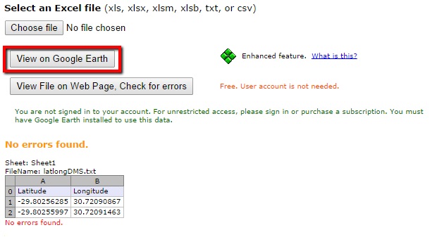
9. Select "Choose file" and upload your new file
10. Pick "View File on Web Page" to check for issues. Your points will display in a grid as shown in the image below:
11. Pick "View on Google Earth"
12. You can view on Google Earth, and if you want to use Google Earth to create a kmz file that you can share with clients, check on "Earth Point Excel to KML" in your Temporary Places and then File | Save | Save Place as... and give the file a name.
NOTE: While we can use this tool to export points to Google Earth, MicroSurvey CAD, MapScenes and STAR*NET have export options that can include linework, layer assignments, custom colour settings and Least Squares Adjustment graphics, please inquire about these products if your requirements are more complex.
James Johnston
Comments